Get the weekly SPARTANAT newsletter.
Your bonus: the free E-Book from SPARTANAT.
Escape Map Berlin
WNDSN has created an escape map of Berlin to commemorate the 35th anniversary of the Berlin Wall's fall, inspired by WWII silk maps used by pilots. This 63 x 63 cm map features a blend of old and new street layouts, marking the Wall's course and offering a unique perspective for history enthusiasts and Berlin explorers alike.

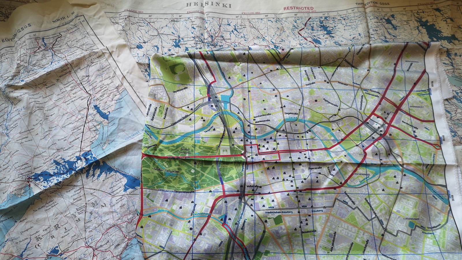
During World War II, the British issued printed maps on silk to their pilots. If they were shot down, the pilots could navigate and simultaneously had something valuable to trade. Well into the Cold War, such maps were also issued to pilots of the USA's strategic bomber fleet. Our friend WNDSN was inspired by this and created a similar escape map for the 35th anniversary of the fall of the Berlin Wall.
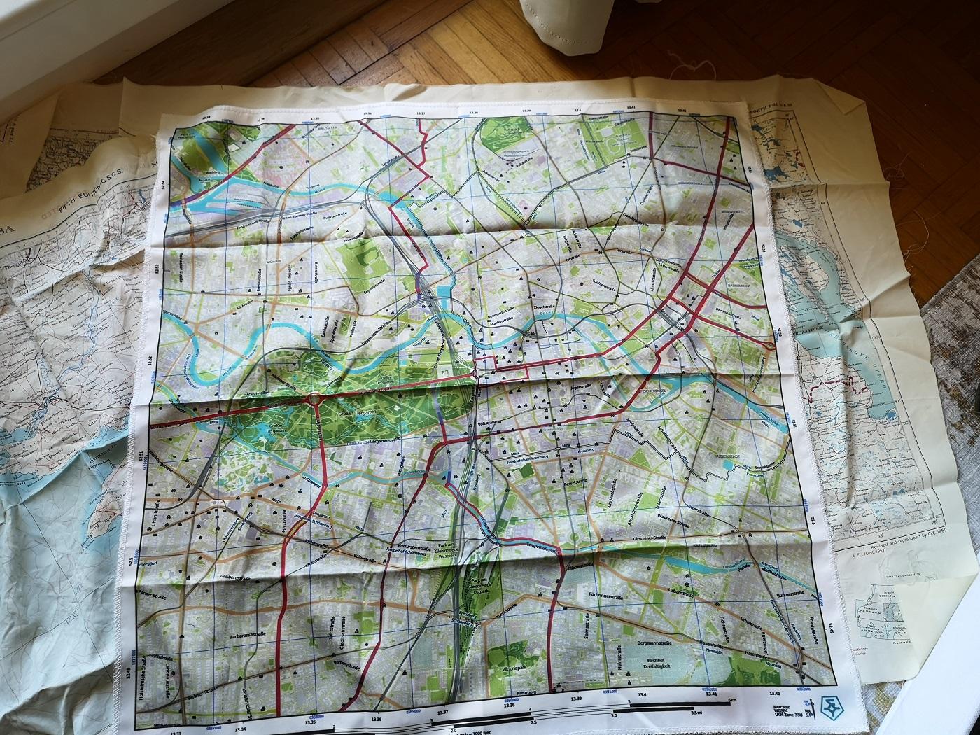
The 63 x 63 cm map, however, is different from its real counterparts, as it is drawn to a smaller scale and combines old and new street layouts. Those who look closely and know Berlin will notice that it is a current map of the city center, which also marks the course of the Berlin Wall.
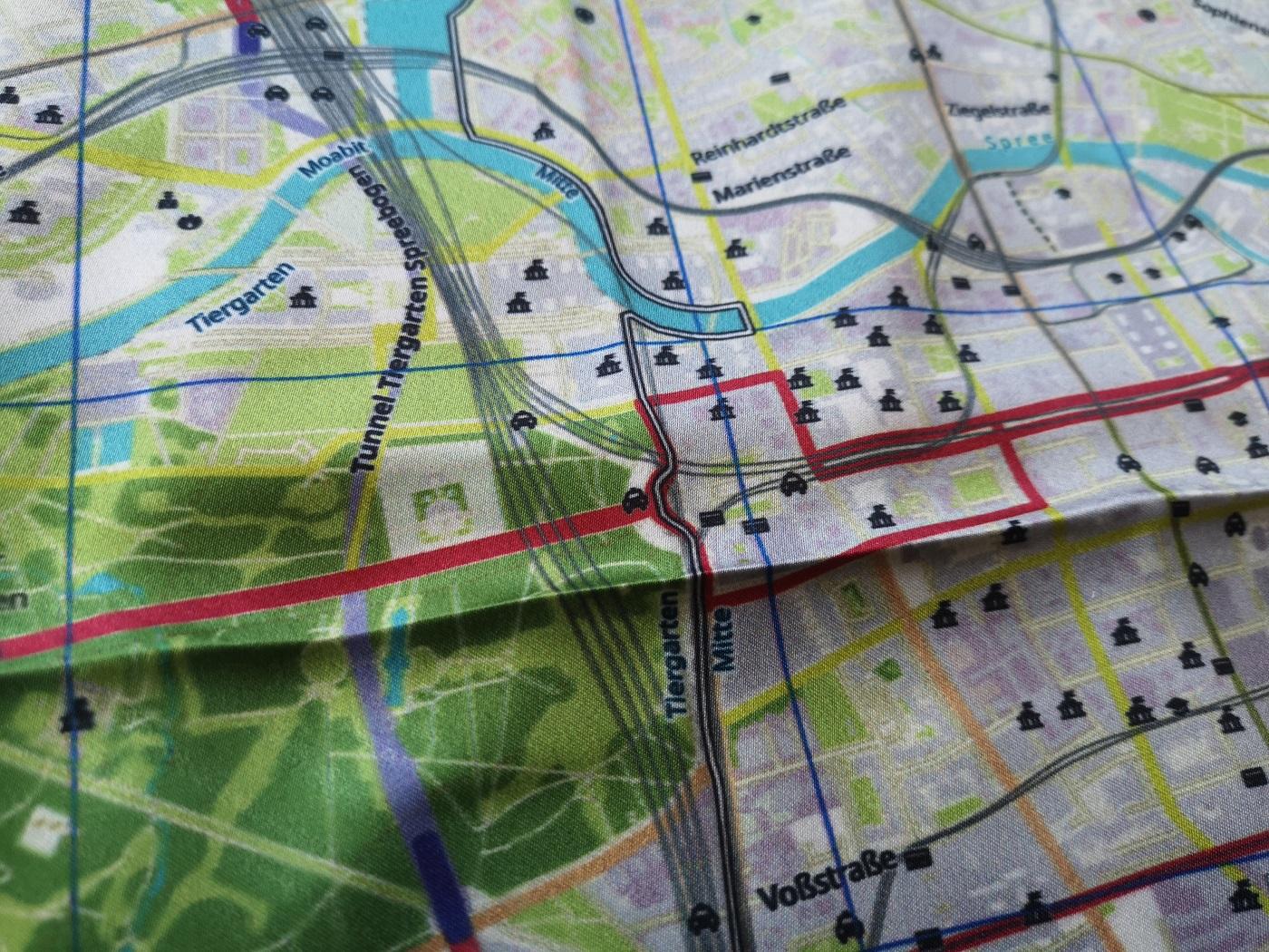
Here, the Brandenburg Gate and the Wall can be seen beautifully as they wind through Berlin.
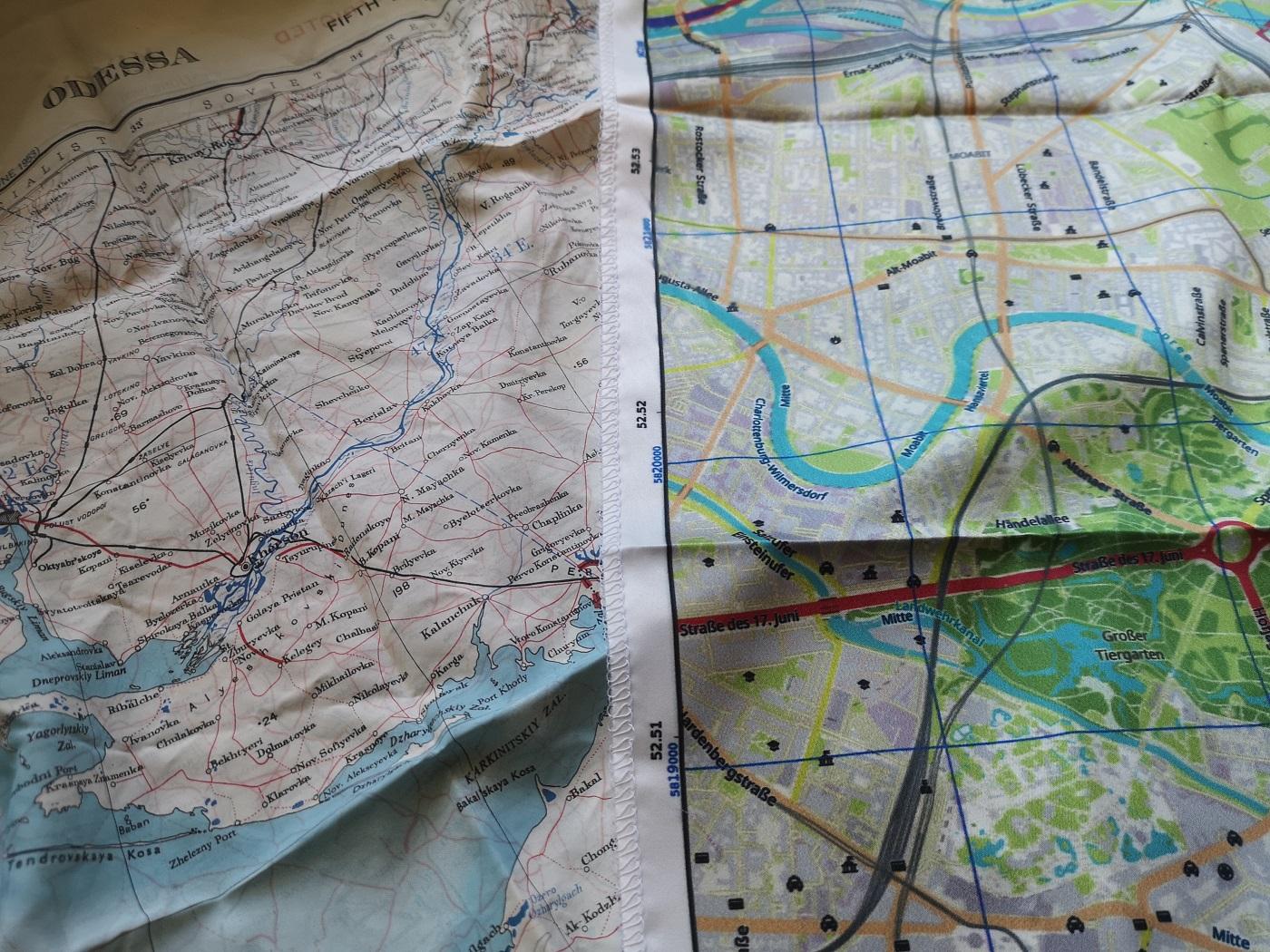
Here is WNDSN's escape map of Berlin compared directly to an original map from 1953. We find the new version very successful.
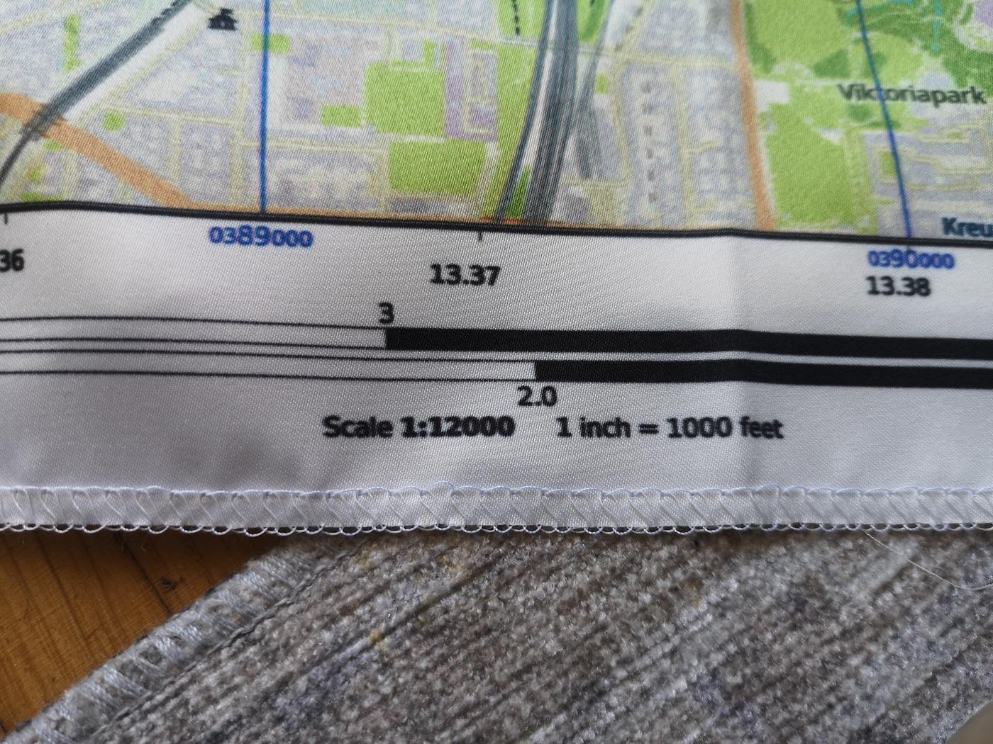
Of course, a scale indication on a map is essential.
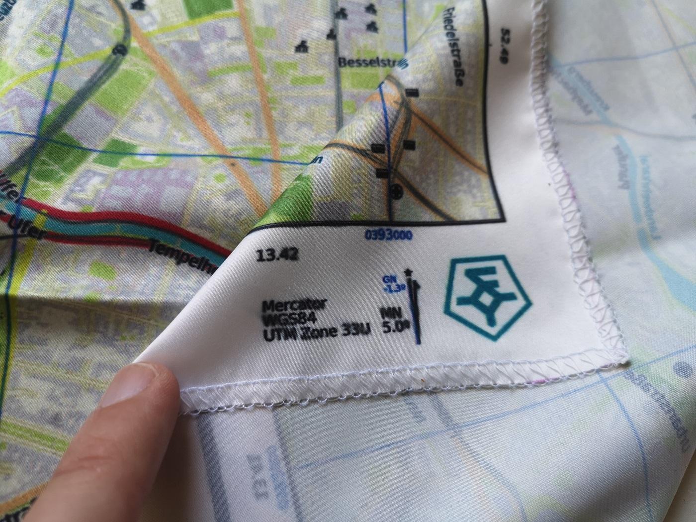
Data on the projection and declination used is also printed on it.
Conclusion
A very successful product, in our opinion. An exciting idea well executed. All fans of historical military knowledge will surely enjoy this. Of course, anyone who has always wanted to walk along the Berlin Wall will also appreciate it.
The escape map of Berlin is available directly from WNDSN for 50 euros.
SPARTANAT is the online magazine for Military News, Tactical Life, Gear & Reviews.
Send us your news: [email protected]
Ad
similar
Get the weekly SPARTANAT newsletter.
Your bonus: the free E-Book from SPARTANAT.